
The Tongariro Alpine Crossing is frequently labeled as one of the best, if not the best, day hikes in the entire world. This is supported by the fact that during its peak season, thousands of people hike the Tongariro Alpine Crossing every day. Does this volcanic wonderland live up to its reputation? Read on to find out!
Contents
About Tongariro National Park
Perhaps most notably, Tongariro National Park is home to the wildly popular Tongariro Alpine Crossing hike. Tongariro National Park is located right in the center of the North Island of New Zealand and contains a large part of the Taupo Volcanic Zone. There are three volcanoes in the park: Mount Tongariro, Mount Ngauruhoe, and Mount Ruapehu.
Even though many Kiwis (New Zealanders) pronounce location names incorrectly, doing your best to use correct Maori pronunciations shows respect and helps keep Te Reo Maori (the Maori language) alive:
Tongariro: Toh-Nuh-Ree-Row
Ngauruhoe: Gnaw-Roo-Hoy
Ruapehu: Roo-Uh-Peh-Hoo
Taupo: Toe-Paw
The Tongariro Alpine Crossing is a 19.4 km (12 mi) one-way hike. While it is just a part of a much longer circuit (the Tongariro Northern Circuit, a New Zealand Great Walk) which covers much more of the park, the Alpine Crossing affords views of all three volcanoes, four very colorful lakes, volcanic craters, and much more. All in just a day!
While Tongariro National Park is known around the world for its spectacular views and hikes, it has immense cultural significant to local iwi (Maori tribes).
More About the Cultural Significance of Tongariro
Read on to find out what to expect and what you can do to be well-prepared and help protect the mountains.
My Experiences on the Tongariro Alpine Crossing

The experiences I’ve had during my trips to Tongariro National Park have been some of the best of my life. I have completed the crossing in several different ways, including forwards, backwards, halfway and back from both directions, rain and shine. I’ve found that the most enjoyable way is, in fact, the way almost everyone does it, from the Mangatepopo car park to the Ketetahi car park. Though 19.4 kilometers (12 miles) may seem like quite the hike, only some of the crossing is uphill. Thanks to the volcanic craters, some of the hike is flat and half is almost entirely downhill.
The Hike
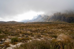
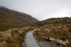
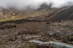
Beginning at the Mangatepopo car park, I’ve always been greeted by lots of fog and clouds as I’ve made my way over boardwalks and through fields of lava. If you’re lucky though, you might just get a view of Mt. Ngauruhoe’s peak, giving a taste of what’s to come.

Click to Enlarge
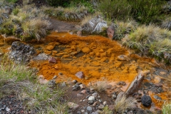
Be extremely careful to stay on all paths, especially during this portion of the crossing, as the mosses and streams are very delicate and could easily be damaged by a single footstep.
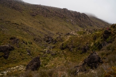
After passing by the fields of lava and a small waterfall, I reached the infamous Devil’s Staircase, the long stretch of trail/stairs that climbs 300 meters up from the flat beginning of the crossing to the first crater.
Click to Enlarge
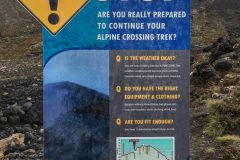
Despite the warning sign, and despite not going to the gym as much as I’d like, I didn’t find the Devil’s Staircase to be too horrible. Even my 60 year old mom managed to do all right!
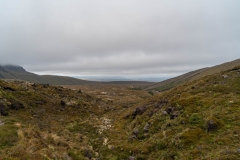
Finally, we reached the wonderfully flat South Crater. As the clouds cleared, Mount Ngauruhoe and the path to the Red Crater finally showed themselves, making the 300 meter ascent well worth it.


Though this final major climb isn’t nearly as steep or long as the Devil’s Staircase, seeing the peak up ahead makes it seem like it takes forever. Luckily, once we got up to the rim of the South Crater, we were rewarded with incredible views of the crater and of the Oturere valley on the other side.

Pictures from ledge overlooking the river and stuff fr below

From here to the Red Crater (the highest point on the crossing), the path is totally exposed, rocky, and slippery. In bad weather, this stretch is particularly tricky and dangerous, so take your time and watch your footing. Once we neared the top of the path, we finally got our first view of the glorious Red Crater.


If you’re there on a particularly clear day, you might be able to see Ngauruhoe from the Red Crater. Out of the four times I’ve completed this hike, I’ve only gotten this view once, so plan and watch the forecast carefully if the visibility is important to you.

From the highest point next to the Red Crater, we got an incredible view of all three Emerald Lakes and even Blue Lake almost 1.5 kilometers away. Here, the path is entirely made up of fine volcanic sand and it is very difficult to keep your footing.


Once we made it down the steep volcanic sand to the three Emerald Lakes, we got a view that I never thought would be possible. Out of the previous three times I had completed the Tongariro Alpine Crossing, I had never even been able to see the Red Crater and Mount Ngauruhoe together; clouds had always blocked the view. Now, the sky was so clear that Tongariro’s Red Crater, Mount Ngauruhoe, and Mount Ruapehu (18 kilometers away!) were all lined up in a row and completely visible.


I was sad to see this rare, incredible view disappear as we continued on the crossing. We got to see a couple more areas of volcanic activity as we descended towards the Ketetahi car park and could even see as far as Lake Rotoaira and Lake Taupo to the North.

From here, there was a long, winding path descending towards a small hut you can camp at and finally, the wooded area where the car park lies. As much as I enjoy the Tongariro Alpine Crossing, the sight of the car park after a long day has always filled me with immeasurable joy.
Though I certainly haven’t done enough day hikes around the world to say whether the Tongariro Alpine Crossing lives up to its reputation, I can see why it’s often called one of the “best day hikes.” The volcanic landscape, colorful lakes, and varying terrain that you can see on this not-too-difficult hike in just a day is unlike anything else in the world.
I can’t speak towards “best day hike ever,” but the Tongariro Alpine Crossing and Tongariro National Park is my absolute favorite location in all of New Zealand. Even with how many times I’ve completed the crossing, I’d do it again in a heartbeat given the chance. It’s a landscape so beautiful that I could never get tired of it.
Would you brave the Devil’s Staircase for these views? Is the Tongariro Alpine Crossing on your list of New Zealand destinations to visit?
Let me know in the comments down below!
Know Before You Go
- The Tongariro Crossing is NOT a loop, meaning you will not return to where you began the hike. Also, the Mangatepopo car park has a 4 hour parking restriction, so it is generally not possible to complete the hike as a loop. Because of this, the best way to complete the crossing is to take a shuttle from the Ketetahi car park (the end of the crossing) to the Mangatepopo car park. You can begin the hike there and end the hike where you parked your car.
- There are only a couple of shuttles available per day so buy your tickets at least a few days ahead of time. Get to the car park at least 20 minutes before your shuttle leaves.
- You can traverse the crossing “backwards” (from Ketetahi to Mangatepopo), but the hike will be more difficult and steep. You may also have trouble getting back to your vehicle.
- The weather on the crossing is often unpredictable and can change very quickly. This means you could get some amazing views on what was supposed to be a cloudy day or you could end up in the pouring rain with no visibility. Check the weather beforehand, but also dress/pack for the worst case scenario and leave yourself plenty of time to complete the hike safely.
- The estimated 6 to 8 hours to complete the crossing does not include hiking Mount Ngauruhoe, Mount Tongariro, or lots of time taking pictures. The hike has routinely taken me 10+ hours just because I like to take my time and take lots of photos. Plan your time according to your own hiking style.
- The middle third or so of the crossing is quite arduous (there’s a reason it’s referred to as The Devil’s Staircase). Make sure you are physically fit enough to safely complete the hike.

- The alpine environment on the crossing is extremely fragile. It is very important for the preservation of the environment, and for your own safety, that you stay on paths and boardwalks at all times.
- There are five toilet locations throughout the hike. Please respect the mountain and other hikers by only going to the bathroom in the toilets provided. Bring toilet paper if you’d like some because the toilets do not have toilet paper.

What to Bring and How to Prepare
- Appropriate clothing
Even during the summer, there are several parts of the crossing that can be quite windy and cold. Wear lots of layers and prepare for the weather to change quickly, regardless of the forecast. I recommend a raincoat/windbreaker to protect from possible rain and from the wind. - Good Shoes
Make sure your sneakers or hiking boots are durable, water-resistant, and can withstand volcanic sand. - Sunscreen
In New Zealand, the UV index is very high due to a lack of ozone in the atmosphere. Even on a cloudy day, most people can get sunburns and skin damage quickly so bring good sunscreen and reapply it often. - Plenty of Water & Snacks
The New Zealand Backpacker Guide recommends 1.5 – 3 liters of water per person. - Alert Someone of Where You’ll be Hiking
Every year, many people need to be rescued on the crossing. Let someone know where you’ll be and when you expect to complete the hike in case of an emergency. Though I had cell service (through Spark) for most of the hike, don’t count on being able to use your phone because the mountains can block the signal.




3 Comments
Mahala · December 8, 2019 at 9:04 pm
Best time in my life. Love you. Mom
SEO Service · January 30, 2020 at 8:19 am
Awesome post! Keep up the great work! 🙂
Ultimate Lord of the Rings Road Trip - Walking into Mordor and Other Traveling Tales · October 20, 2021 at 12:43 pm
[…] Recommended non-LOTR Stop: The Tongariro Alpine Crossing […]